Some things you simply cannot see from the ground. The full scale of a property. The layout of a construction site. The way a horse farm stretches from paddock to treeline. Aerial photography reveals what ground-level cameras miss, and for a growing number of industries in Ocala and Central Florida, it has become essential.
At Avera Visuals, we are FAA Part 107 certified remote pilots providing professional drone photography and videography across Central Florida. We handle everything from airspace coordination and flight planning to post-production, so you get polished aerial content without the regulatory headache.
Why drone photography matters
Aerial imagery used to require a helicopter and a five-figure budget. Now it is accessible, affordable, and increasingly expected. According to the National Association of Realtors, real estate listings with aerial footage sell 68% faster. Construction companies use drone documentation to track progress and resolve disputes. Tourism and hospitality businesses use flyover video to give potential guests a sense of place before they book.
If your business involves physical space, land, or large-scale projects, drone photography is no longer optional. It is a competitive baseline.
What we capture from the air
Real estate and development
Whether it is a single-family listing, a luxury equestrian estate, or a multi-phase commercial development, aerial photography shows the full picture. Lot boundaries, surrounding amenities, road access, neighboring properties. Buyers and investors want to understand the context before they visit in person, and drone imagery delivers that instantly.
Construction progress documentation
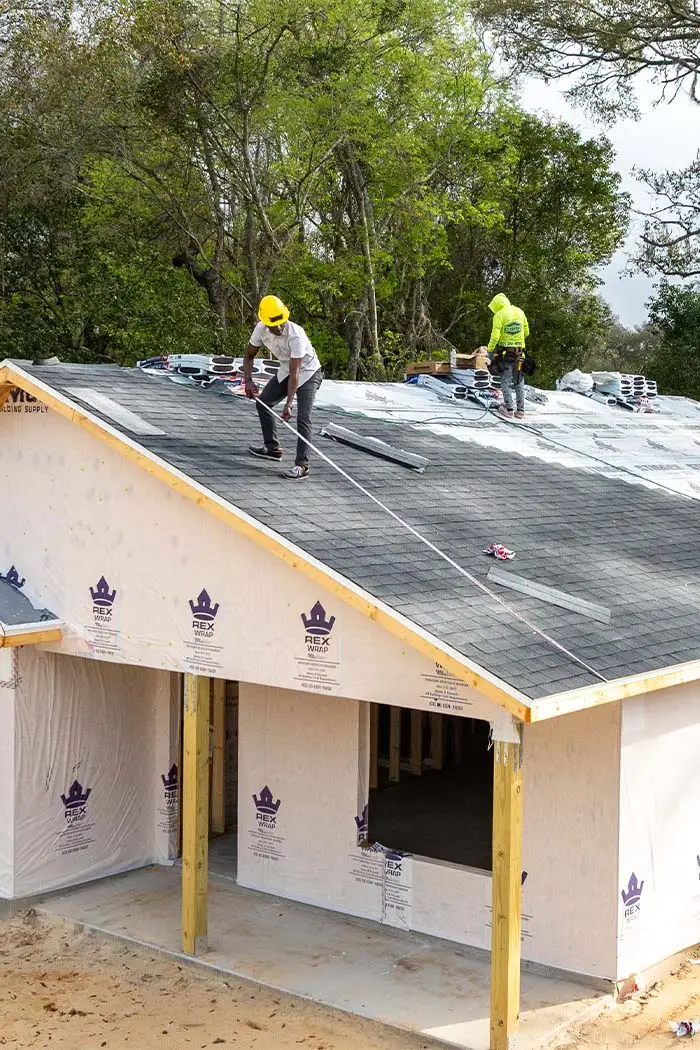
Drone photography is one of the most efficient ways to document a construction project over time. Monthly or milestone flyovers create a visual record that supports draw requests, investor reporting, and dispute resolution. We coordinate with site supervisors to maintain safety compliance while capturing comprehensive overhead documentation.
Equestrian properties and farms
Ocala is the Horse Capital of the World, and the equestrian industry here depends on property marketing at a scale that ground-level photography cannot fully capture. A drone reveals the layout of barns, paddocks, arenas, and pastures in a way that helps buyers and breeders evaluate a property before they ever set foot on it.
Event venues and hospitality
Hotels, resorts, wedding venues, and event spaces use aerial photography to show the full scope of what they offer. A drone flyover of the World Equestrian Center or a countryside estate gives prospective clients a feel for the property that no ground-level photo gallery can match.
Agriculture and land management
Marion County’s agricultural operations benefit from aerial documentation for crop monitoring, land surveys, irrigation planning, and property marketing. Drone photography provides an overhead perspective that simplifies decision-making for landowners and farm managers.
FAA certification and compliance
Commercial drone photography is federally regulated, and cutting corners is not worth the risk. Fines for operating commercially without proper certification can reach $32,666 per violation.
Every aerial project we take on is fully compliant with FAA Part 107 regulations. We hold current Remote Pilot Certificates, carry commercial drone insurance, and handle all airspace authorizations and LAANC approvals. Ocala sits in largely uncontrolled airspace, which is favorable for drone operations, but proximity to Ocala International Airport and other flight restrictions still require careful planning. We handle all of that before we ever launch.
Drone photography and video from one team
Aerial content is most powerful when it integrates with your ground-level marketing. A property listing that opens with a sweeping drone reveal and transitions to interior photography tells a complete visual story. A construction documentation project that combines aerial progress shots with ground-level detail photos gives stakeholders a full picture.
Because we handle drone work alongside all of our other photography and videography services, everything stays visually consistent. One team, one style, one delivery.
Frequently asked questions
How much does drone photography cost in Ocala?
Pricing depends on the project scope, including the number of locations, whether you need photo, video, or both, and whether the project is a one-time shoot or recurring documentation. We provide custom quotes for every project.
Do you need FAA approval to fly a drone commercially?
Yes. Commercial drone operators must hold an FAA Part 107 Remote Pilot Certificate. All of our pilots are certified, insured, and current on their credentials.
Can you do recurring drone visits for construction projects?
Absolutely. We offer monthly, quarterly, and milestone-based documentation programs for construction and development projects.
What kind of drone do you use?
We fly commercial-grade DJI platforms equipped with high-resolution cameras capable of 4K video and large-format still photography.
How far in advance do I need to book?
We recommend at least one to two weeks of lead time for standard projects. Airspace authorizations can take 24 to 48 hours in some zones.
Need aerial content in Ocala or Central Florida? Start a project with Avera Visuals and let’s get a new perspective on your property, project, or brand.